MAKE A MEME
View Large Image
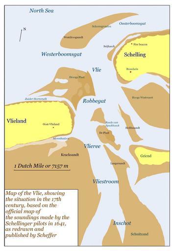
| View Original: | Vlie9.JPG (3088x4510) | |||
| Download: | Original | Medium | Small | Thumb |
| Courtesy of: | commons.wikimedia.org | More Like This | ||
| Keywords: Vlie9.JPG Map of Vlie area based on the 1641 map made by the Schellinger pilots Own 2007 MWAK 1641 Maps showing 17th-century history Maps of the Wadden Sea Maps of Terschelling Maps of Vlieland | ||||