MAKE A MEME
View Large Image
| View Original: | USGS map Albers conic tall.gif (335x195) | |||
| Download: | Original | Medium | Small | Thumb |
| Courtesy of: | commons.wikimedia.org | More Like This | ||
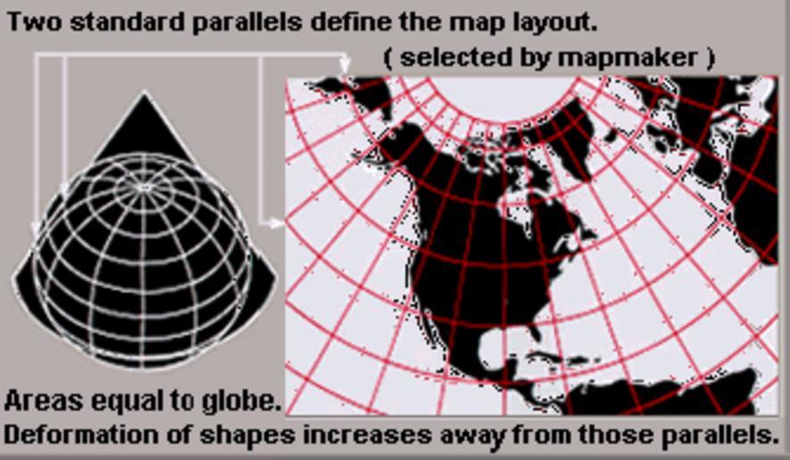
| Keywords: USGS map Albers conic tall.gif Albers conic-projection maps rearranged as taller image from larger wider USGS file of GIF format See enlarged view below using a wikitable to expand beyond original size derivative from USGS image file magnified 20 made taller URL http //erg usgs gov/isb/pubs/MapProjections/graphics/albers gif User Wikid77 rearranging US Government USGS image 2007-11-15 Wider image with blurred lettering speckles 41 more data PNG format Image Usgs map albers equal area conic PNG this crap sso sucks Enlarged view wikitable align right - Ā420px<br/> <small>Explanation of Albers equal-area conic projection </small> - PD-USGov-USGS Albers projection USGS projections ImageNote 1 149 141 8 8 335 195 2 this kind of Map Projection can be used for the Northern hemisphere particularly for area that have smaller spatial extent ImageNoteEnd 1 | ||||