MAKE A MEME
View Large Image
| View Original: | US smarteststate.jpg (1182x801) | |||
| Download: | Original | Medium | Small | Thumb |
| Courtesy of: | commons.wikimedia.org | More Like This | ||
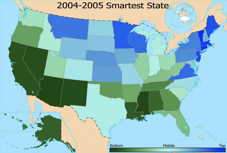
| Keywords: US smarteststate.jpg Color-coded map of a 2004-2005 ranking of states with the smartest in blue Data is based upon the findings of Morgan Quitnohttp //www morganquitno com/edrank04 htm which is available to the public Cnelson talk - The map is my own creation based upon this image Image US state outline map png from the USGS wikicommons 03 58 23 March 2006 Cnelson talk Cnelson en Original upload log en wikipedia FtCG page en wikipedia US_smarteststate jpg wikitable Date/Time Dimensions User Comment - 04 18 23 March 2006 1 182 × 801 204 796 bytes Cnelson w en <nowiki> </nowiki> - 03 58 23 March 2006 1 182 × 801 211 374 bytes Cnelson w en <nowiki> Color-coded map of a 2005-2006 ranking of states with the smartest in blue Data is based upon the findings of Morgan Quintohttp //www morganquitno com/edrank04 htm which is avaliable to the public The map is my own creation based upon this image </nowiki> version lost Uncategorized 2015 April 27 | ||||