MAKE A MEME
View Large Image
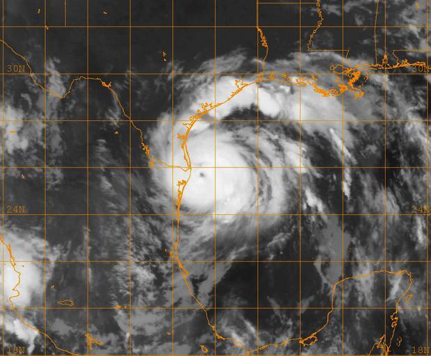
| View Original: | US_Navy_080723-N-0000W-001_A_GOES-12_infrared_satellite_image_provided_by_the_U.S._Naval_Research_Laboratory,_Monterey,_Calif.,_showing_the_status_of_Hurricane_Dolly_at_approximately_4-45_am_EST.jpg (1024x845) | |||
| Download: | Original | Medium | Small | Thumb |
| Courtesy of: | commons.wikimedia.org | More Like This | ||
| Keywords: US Navy 080723-N-0000W-001 A GOES-12 infrared satellite image provided by the U.S. Naval Research Laboratory, Monterey, Calif., showing the status of Hurricane Dolly at approximately 4-45 am EST.jpg en CARIBBEAN SEA July 23 2008 A GOES-12 infrared satellite image provided by the U S Naval Research Laboratory Monterey Calif showing the status of Hurricane Dolly at approximately 4 45 am EST Dolly is a Category 1 hurricane on the Saffir-Simpson hurricane scale with maximum sustained winds near 85 mph and higher gusts The storm is approaching the U S /Mexico border near Brownsville Texas and is expected to strengthen before making landfall U S Navy photo Released 2008-07-23 080723-N-0000W-001 Navy http //www navy mil/view_image asp id 61703 U S Navy photo PD-USGov-Military-Navy Hurricane Dolly 2008 GOES 12 pictures Satellite pictures of hurricanes | ||||