MAKE A MEME
View Large Image
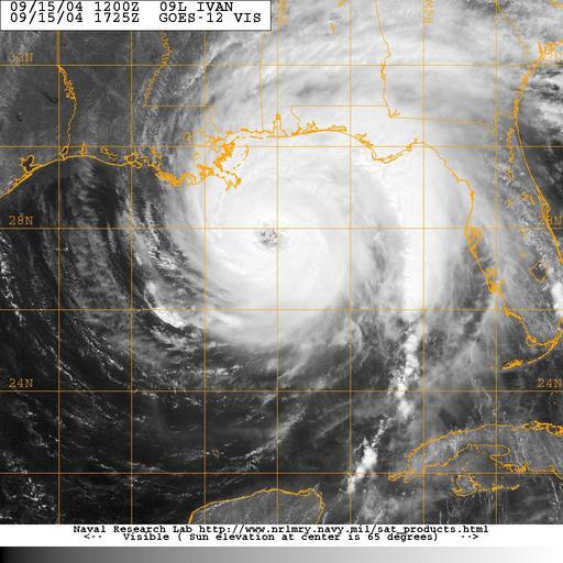
| View Original: | US_Navy_040915-N-0000X-002_Satellite_image_taken_from_the_GOES-12_satellite_of_Hurricane_Ivan_at_approximately_1325_EST.jpg (1024x1024) | |||
| Download: | Original | Medium | Small | Thumb |
| Courtesy of: | commons.wikimedia.org | More Like This | ||
| Keywords: US Navy 040915-N-0000X-002 Satellite image taken from the GOES-12 satellite of Hurricane Ivan at approximately 1325 EST.jpg en Gulf of Mexico Sept 15 2004 Satellite image taken from the GOES-12 satellite of Hurricane Ivan at approximately 1325 EST Ivan an extremely dangerous category four hurricane on the Saffir-Simpson Hurricane scale has maximum sustained winds near 135 mph with higher gusts Hurricane force winds extend outward up to 105 miles from the center and tropical storm force winds extend outward up to 290 miles The well-defined eye of hurricane Ivan was located about 235 miles south of Mobile Al Hurricane Ivan has killed at least 68 people in the Caribbean and it is expected to make landfall early tomorrow morning between New Orleans La and Apalachicola Fla at approximately 0600 EST Photo provided by Naval Atlantic Meteorology and Oceanography Center RELEASED For more information visit <a href https //weather navy mil Target _BLANK >https //weather navy mil</a> 2004-09-15 040915-N-0000X-002 Navy http //www navy mil/view_image asp id 17666 U S Navy photo PD-USGov-Military-Navy Satellite pictures of the Gulf of Mexico Satellite pictures of Hurricane Ivan GOES 12 pictures | ||||