MAKE A MEME
View Large Image

| View Original: | US insular areas-B FAS.png (1482x624) | |||
| Download: | Original | Medium | Small | Thumb |
| Courtesy of: | commons.wikimedia.org | More Like This | ||
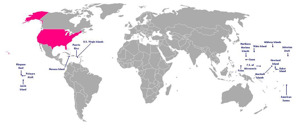
| Keywords: US insular areas-B FAS.png This is a map of the US Insular areas with the freely associated states of the Marshall Islands Palau and the Federated States of Micronesia according to the http //www doi gov/oia/Islandpages/political_types htm US Office of Insular Affairs these islands are insular areas The base map is Image Dependent_territories_2007 png by User Sesmith Names of the islands are from the CIA Factbook For a version color-coded by each islands' status see Image US_insular_areas FAS png For a version without the freely associated states see Image US_insular_areas-B png The previous map is PD; because of this this map is too 2008-03-05 own assumed Hoshie Locator maps of insular areas of the United States Maps of insular areas of the United States | ||||