MAKE A MEME
View Large Image
| View Original: | US_Census_map_of_Salem_Ohio.png (760x551) | |||
| Download: | Original | Medium | Small | Thumb |
| Courtesy of: | commons.wikimedia.org | More Like This | ||
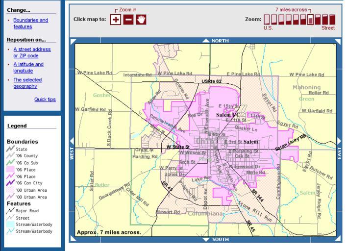
| Keywords: US Census map of Salem Ohio.png en Map of w Salem Ohio showing municipal boundaries From the American FactFinder reference maps at the United States Census Bureau <nowiki>http //factfinder census gov/servlet/ReferenceMapFramesetServlet _bm y -_pan -PANEL_ID rm_result -_MapEvent -_changeMap ZoomIn -_pageY 422 -_zoomLevel -_pageX 455 -_mapY 219 -rm_config 86 en 420 0 0 ref_legal_06pep 0 3997967383107785 0 22717238039512536 gov census aff domain map EnglishMapExtent gif -80 863162 40 90801999999999 5 5 1990 1944 1986 1931 1930 1972 1945 1987 1929 1973 1994 1991 1968 1988 1952 1940 1982 1992 1958 1989 1953 1941 1983 1993 1959 1969 86000US44460 -_mapX 294 -errMsg -redoLog false -geo_id 86000US44460 -_latitude -_lang en -_longitude </nowiki> United States Census Bureau edited by Jeff Billman 2008-07-26 PD-USGov Maps of cities in Ohio Maps of Columbiana County Ohio Maps of Mahoning County Ohio Salem Ohio | ||||