MAKE A MEME
View Large Image
| View Original: | Uribe map historical.gif (261x167) | |||
| Download: | Original | Medium | Small | Thumb |
| Courtesy of: | commons.wikimedia.org | More Like This | ||
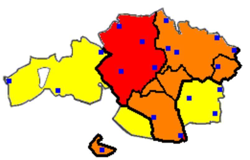
| Keywords: Uribe map historical.gif en Map of Uribealdea Uribe eskualdea in the context of historical formation of Biscay Red Uribealdea Orange other constituent districts of Biscay Yellow later incorporations Blue dots chartered towns and cities eu Uribe eskualde historikoaren planoa http //en wikipedia org/wiki/File Uribe_map_historical gif http //en wikipedia org/wiki/User Sugaar 2006ko azaroaren 1a Eskualdeak of Biscay Maps of the history of the Basque Country cc-zero | ||||