MAKE A MEME
View Large Image
| View Original: | Uotsurijima Map.jpg (3431x2645) | |||
| Download: | Original | Medium | Small | Thumb |
| Courtesy of: | commons.wikimedia.org | More Like This | ||
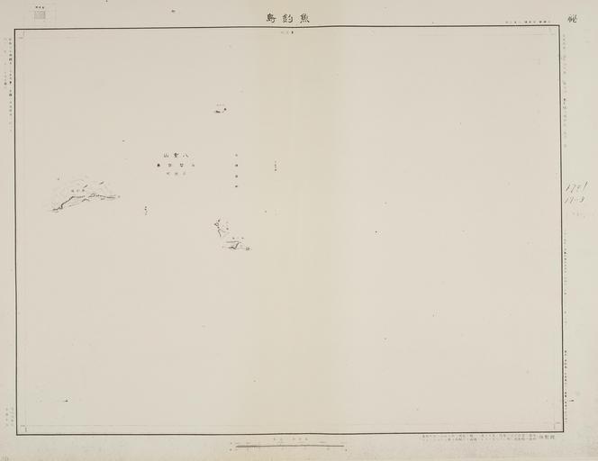
| Keywords: Uotsurijima Map.jpg Map of Uotsurijima includes most of other Senkaku Islands issued in Japan 1936 Õż¦µŚźµ ¼ÕĖ ÕøĮķÖĖĶ╗ŹÕÅéĶ¼ µ ¼ķā©ķÖĖÕ ░µĖ¼ķćÅķā©õĮ µłÉŃ īķŁÜķćŻÕ│ČÕ ░Õø│Ń Ź’╝ł1930Õ╣┤µĖ¼Õø│Ńā╗1936Õ╣┤ńÖ║ĶĪī’╝ēŃ üõ╗¢Ńü«Õ░¢ķ¢ŻĶ½ĖÕ│ČŃéÆÕɽŃé http //www geocities jp/tanaka_kunitaka48/uotsurijima-1936/01 jpg µśŁÕÆī11Õ╣┤ ķÖĖÕ ░µĖ¼ķćÅķā©’╝łÕøĮÕ ¤Õ ░ńÉåķÖóŃü«ÕēŹĶ║½’╝ē PD-Japan Documents of Senkaku Islands Geography of Okinawa prefecture Old maps of Japan | ||||