MAKE A MEME
View Large Image
| View Original: | Universum_(Wien)_Lageplan_1856.jpg (704x576) | |||
| Download: | Original | Medium | Small | Thumb |
| Courtesy of: | commons.wikimedia.org | More Like This | ||
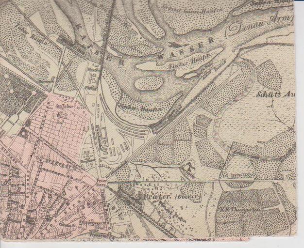
| Keywords: Universum (Wien) Lageplan 1856.jpg en Part of a city map of Vienna in 1856 showing the location of the Universum entertainment establishment in an area close to the Danube since 1850 being part of Vienna's 2nd district de Ausschnitt aus einem Stadtplan Wiens aus dem Jahr 1856 der den Standort des Vergnügungsetablissements Universum am Rand der Donauauen zeigt Das Areal war seit 1850 Teil des 2 Wiener Gemeindebezirks Wien und seine Vorstädte 1856 Stadtplan Oertliche Entwicklung der Stadt Wien vom Mittelalter bis zur Gegenwart Nach amtlichen Quellen bearbeitet vo n Conrad Grefe Verlag des Wiener Magistrats 1892-01-01 PD-old History of Brigittenau History of Leopoldstadt Old maps of Vienna Nordwestbahnstraße Vienna Conrad Grefe | ||||
_Lageplan_1856.jpg)