MAKE A MEME
View Large Image
| View Original: | Un-mali Kayes Region.png (692x594) | |||
| Download: | Original | Medium | Small | Thumb |
| Courtesy of: | commons.wikimedia.org | More Like This | ||
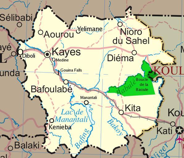
| Keywords: Un-mali Kayes Region.png Map of the Kayes Region of Mali Additions include new northern road via Diema several towns downgrade of road in fact unpaved from Kayes to Kenieba Solid pink lines are paved dashed are unpaved Addition of National park of Boucle du Baoule Ref Ross Velton Mali Bradt UK and Globe Pequot US 2005/2006 ISBN 9781841620770 Made with GIMP self-made edit crop recolored several additions to Image Un-mali png from http //www un org/Depts/Cartographic/english/htmain htm 2008-03-04 T L Miles Modified versions of UNCS maps may be used provided that the UN name and reference number does not appear on any modified version and a link to the original map is provided Modified UN maps are to be considered in the public domain This applies worldwide SEE UN map Image Un-mali png Maps of Mali Kayes Region | ||||