MAKE A MEME
View Large Image
| View Original: | TS_Vicente_2005.jpg (3875x3875) | |||
| Download: | Original | Medium | Small | Thumb |
| Courtesy of: | commons.wikimedia.org | More Like This | ||
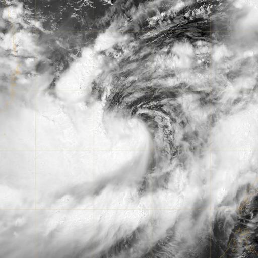
| Keywords: TS Vicente 2005.jpg This image of Tropical Storm Vicente was captured by the MODIS instrument on NASA's Aqua satellite at 0546 UTC when it was located in the South China Sea The maximum sustained winds for the storm were 30 knots 10-minute average and the minimum pressure was about 1000 mb http //www nrlmry navy mil/tc_pages/tc_home html 2005-11-10 Naval Research Laboratory PD-USGov-Military-Navy Tropical Storm Vicente 2005 NASA MODIS images of tropical cyclones Vicente 2005 | ||||