MAKE A MEME
View Large Image
| View Original: | Trails of Tears en.png (2025x1547) | |||
| Download: | Original | Medium | Small | Thumb |
| Courtesy of: | commons.wikimedia.org | More Like This | ||
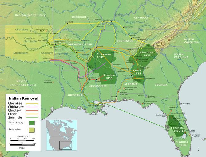
| Keywords: Trails of Tears en.png Map of the route of the Trails of Tears ” for ethnic cleansing of Native Americans from the Southeastern United States between 1836 and 1839 The forced march of Cherokee removal from the Southeastern United States for forced relocation to the Indian Territory present day Oklahoma English version Own work by Nikater submitted to the public domain Background map courtesy of Demis www demis nl and Wilcomb E Washburn Hrsg Handbook of North American Indians Vol 4 History of Indian-White Relations Smithsonian Institution Press Washington D C 1988 ISBN 0-16004-583-5 2007-09-04 User Nikater PD-Demis Trail of Tears 01 Maps of Native American tribal territories Maps of the history of the United States Indian Territory Alabama in the 1830s Florida in the 1830s Georgia U S state in the 1830s North Carolina in the 1830s Oklahoma in the 1830s South Carolina in the 1830s Tennessee in the 1830s Texas in the 1830s 1836 in the United States 1837 in the United States 1838 in the United States 1839 in the United States History of Oklahoma Southeastern United States | ||||