MAKE A MEME
View Large Image
| View Original: | Tornado Outbreak 1985-05-31 map Ontario.PNG (1076x443) | |||
| Download: | Original | Medium | Small | Thumb |
| Courtesy of: | commons.wikimedia.org | More Like This | ||
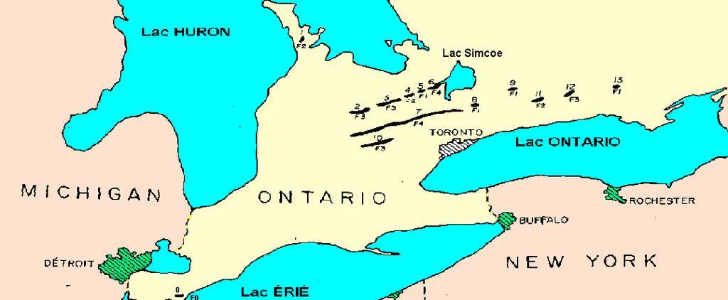
| Keywords: Tornado Outbreak 1985-05-31 map Ontario.PNG en French version from map in on http //www erh noaa gov/er/cle/office/localinterest/1985Tornado/storm_data pdf NOAA report showing the track of tornadoes in Ontario during the May 31st 1985 Outbreak Under is the area affected corresponding to the numbers on the map fr Version française de la carte http //www erh noaa gov/er/cle/office/localinterest/1985Tornado/storm_data pdf du rapport de la NOAA pour les tornades en Ontario durant l'Ă©ruption de tornades du 31 mai 1985 Ci-dessous la liste des tornades correspondant aux numĂ©ro de la carte 0 Leamington Rush Cove Hopeville Corberton Borden Essa Barrie Grand Valley Wagner Lake Reavoro Alma Ida Rice Lake Minto own Pierre cb 2010-08-06 PD-USGov-NOAA 1985 United States “ Canadian tornado outbreak | ||||