MAKE A MEME
View Large Image
| View Original: | Tornado_Alley.png (550x406) | |||
| Download: | Original | Medium | Small | Thumb |
| Courtesy of: | commons.wikimedia.org | More Like This | ||
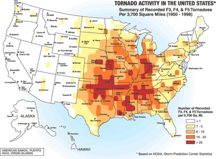
| Keywords: Tornado Alley.png A map of the frequency of F3 and greater intensity tornadoes by area The darker colors highlight the area typically known as Tornado Alley Source Image from a booklet from http //www fema gov/index shtm Federal Emergency Management Agency a United States government agency titled http //www fema gov/plan/prevent/saferoom/tsfs02_torn_activity shtm Taking Shelter from the Storm Building a Safe Room Inside your House FEMA 320 Figure 1 1 page 3 and thought to be in the public domain Area 700x522 pix PD-USGov Maps of North Americian tornadoes | ||||