MAKE A MEME
View Large Image
| View Original: | Theoreticaltownshipmap.gif (694x751) | |||
| Download: | Original | Medium | Small | Thumb |
| Courtesy of: | commons.wikimedia.org | More Like This | ||
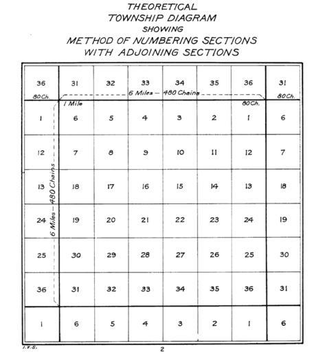
| Keywords: Theoreticaltownshipmap.gif en The image depicts a standard survey township with its 36 sections and the correponding sections from the surrounding survey townships 2011-12-22 The image was tansferred from the en wiki If necessary it could be found http //upload wikimedia org/wikipedia/en/9/95/Theoreticaltownshipmap gif here The image was done by the US Interior Bureau of Land Management PD-USGov-Interior-BLM PD-USGov PD-USGov-Interior-BLM Economy of the United States Geography of the United States Political history of the United States Subdivisions of the United States Surveying in the United States Topography Uploaded with UploadWizard | ||||