MAKE A MEME
View Large Image
| View Original: | The_Malabar_(southwest)_and_Coromandel_(southeast)_coasts,_with_their_network_of_small_trading_ports,_1749.jpg (707x549) | |||
| Download: | Original | Medium | Small | Thumb |
| Courtesy of: | commons.wikimedia.org | More Like This | ||
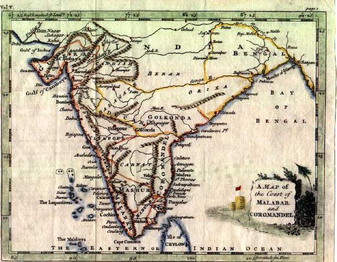
| Keywords: The Malabar (southwest) and Coromandel (southeast) coasts, with their network of small trading ports, 1749.jpg The Malabar southwest and Coromandel southeast coasts with their network of small trading ports 1749 Source ebay Nov 2004 Thomas Jeffreys was an English engraver geographer publisher whose work was both prolific and of a high standard This attractive map comes from the series he engraved for Salmon's Geographical Grammar first published in 1749 and is from the 1764 edition http //www columbia edu/itc/mealac/pritchett/00routesdata/0500_0599/shipping/coastalmaps/coastalmaps html 1764 Thomas Jeffreys PD-Old India | ||||
_and_Coromandel_(southeast)_coasts,_with_their_network_of_small_trading_ports,_1749.jpg)