MAKE A MEME
View Large Image
| View Original: | THE_ANDROSCOGGIN_RIVER_FLOWS_BETWEEN_LEWISTON_(EASTERN_SHORE)_AND_AUBURN_(WESTERN_SHORE)._LEWISTON_IS_THE_STATE'S..._-_NARA_-_550728.jpg (3000x2007) | |||
| Download: | Original | Medium | Small | Thumb |
| Courtesy of: | commons.wikimedia.org | More Like This | ||
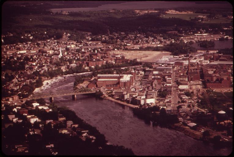
| Keywords: THE ANDROSCOGGIN RIVER FLOWS BETWEEN LEWISTON (EASTERN SHORE) AND AUBURN (WESTERN SHORE). LEWISTON IS THE STATE'S... - NARA - 550728.jpg Scope and content General notes 550728 Local identifier 412-DA-8243 Environmental Protection Agency 12/02/1970 - NARA-Author Steinhacker Charles 1937- Photographer 1660401 <br /> Lewiston Androscoggin Maine United States North and Central America inhabited place 4201781 44 1 -70 2 <br /> Still Picture Records Section Special Media Archives Services Division NWCS-S National Archives at College Park 8601 Adelphi Road College Park MD 20740-6001 06/1973 Record group Record Group 412 Records of the Environmental Protection Agency 1944 - 2006 Record group ARC 708 DOCUMERICA The Environmental Protection Agency's Program to Photographically Document Subjects of Environmental Concern compiled 1972 - 1977 Series ARC 542493 File unit File unit ARC Variant control numbers Agency-Assigned Identifier 138/23/008243<br /> NAIL Control Number NWDNS-412-DA-8243 Other versions <gallery> File THE_ANDROSCOGGIN_RIVER_FLOWS_BETWEEN_LEWISTON_ EASTERN_SHORE _AND_AUBURN_ WESTERN_SHORE _LEWISTON_IS_THE_STATE'S _-_NARA_-_550728 tif tif File THE_ANDROSCOGGIN_RIVER_FLOWS_BETWEEN_LEWISTON_ EASTERN_SHORE _AND_AUBURN_ WESTERN_SHORE _LEWISTON_IS_THE_STATE'S _-_NARA_-_550728 jpg jpg </gallery> NARA-cooperation PD-USGov Androscoggin River | ||||
_AND_AUBURN_(WESTERN_SHORE)._LEWISTON_IS_THE_STATE'S..._-_NARA_-_550728.jpg)