MAKE A MEME
View Large Image
| View Original: | Ten_Mile_River_Basin,_Massachusetts_(USGS).jpg (2051x2536) | |||
| Download: | Original | Medium | Small | Thumb |
| Courtesy of: | commons.wikimedia.org | More Like This | ||
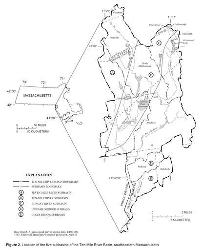
| Keywords: Ten Mile River Basin, Massachusetts (USGS).jpg Diagram of the Ten Mile River water basin southeastern Massachusetts USA M A Horn Method for Estimating Water Use and Interbasin Transfers of Freshwater and Wastewater in an Urbanized Basin United States Geological Survey WRIR-99-4287 Figure 2 Online version at http //pubs usgs gov/wri/wri994287/pdf/text2 pdf 2000 M A Horn Public domain as original work of the US Federal Government PD-USGov Ten Mile River 2000 diagrams | ||||
.jpg)