MAKE A MEME
View Large Image
| View Original: | T_Land_Van_Eendracht_(Waekende_Boey).jpg (800x612) | |||
| Download: | Original | Medium | Small | Thumb |
| Courtesy of: | commons.wikimedia.org | More Like This | ||
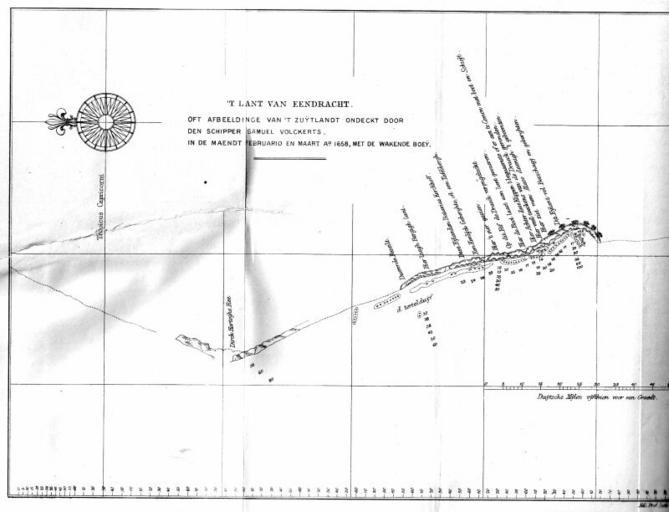
| Keywords: T Land Van Eendracht (Waekende Boey).jpg This is a map showing the north west coast of Australia as charted by the Waekende Boey in 1658 This coastline was then known as The Land of Eendracht because it had previously been charted only by Dirk Hartog in the Eendracht in 1616 Project Gutenberg of Australia edition of Early Voyages in Terra Australis The image is located at http //www gutenberg net au/ebooks06/0600361h-06 jpg Original map dates to the 17th century; Early Voyages in Terra Australis was published in 1859 Primarily Samuel Volkerson skipper of the Waekende Boey; presumably some professional cartographers were involved in production of the final product PD-Art Caert van't Landt van d'Eendracht Maps of Western Australia | ||||
.jpg)