MAKE A MEME
View Large Image

| View Original: | Stary Dzedzin 17th Century be.png (1210x910) | |||
| Download: | Original | Medium | Small | Thumb |
| Courtesy of: | commons.wikimedia.org | More Like This | ||
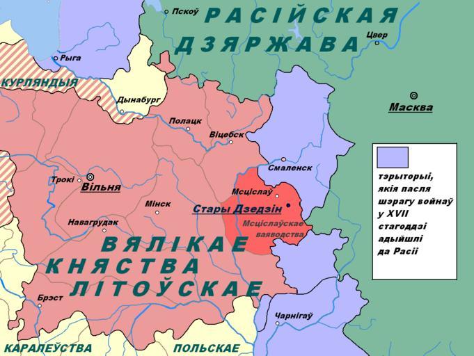
| Keywords: Stary Dzedzin 17th Century be.png en This image shows the location of the village Stary Dzedzin on the political map of the 17th century be ąōčŹčéą░čÅ ą▓čŗčÅą▓ą░ ą┐ą░ą║ą░ąĘą▓ą░ąĄ ą╝ąĄčüčåą░ąĘąĮą░čģąŠą┤ąČą░ąĮąĮąĄ ą▓čæčüą║č¢ ąĪčéą░č čŗ ąöąĘąĄą┤ąĘč¢ąĮ ąĮą░ ą┐ą░ą╗č¢čéčŗčćąĮą░ą╣ ą║ą░č čåąĄ XVII čüčéą░ą│ąŠą┤ą┤ąĘčÅ ru ąŁč鹊 ąĖąĘąŠą▒č ą░ąČąĄąĮąĖąĄ ą┐ąŠą║ą░ąĘčŗą▓ą░ąĄčé ą╝ąĄčüč鹊ąĮą░čģąŠąČą┤ąĄąĮąĖąĄ ą┤ąĄč ąĄą▓ąĮąĖ ąĪčéą░č čŗą╣ ąöąĄą┤ąĖąĮ ąĮą░ ą┐ąŠą╗ąĖčéąĖč湥čüą║ąŠą╣ ą║ą░č č鹥 XVII ą▓ąĄą║ą░ own ąśą│ąŠč čī ąÉą▓ą╗ą░čüąĄąĮą║ąŠ 2011-01-14 Maps of Grand Duchy of Lithuania Maps in Belarusian Maps showing 17th-century history | ||||