MAKE A MEME
View Large Image
| View Original: | Stadtplan_Praterstern_1925.jpg (1275x1744) | |||
| Download: | Original | Medium | Small | Thumb |
| Courtesy of: | commons.wikimedia.org | More Like This | ||
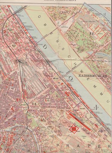
| Keywords: Stadtplan Praterstern 1925.jpg en Part of a city map of the 2nd district of Vienna showing the Praterstern traffic junction Reichsbrücke bridge over the Danube river and adjacent parts of Prater amusement park de Ausschnitt aus einem Stadtplan des 2 Wiener Gemeindebezirks mit dem Praterstern der Reichsbrücke über die Donau und angrenzenden Teilen des Wiener Praters Kartographisches früher Militärgeographisches Institut in Wien Hrsg Plan des II Wiener Gemeindebezirkes Leopoldstadt Wien o J um 1925 Ausschnitt Anonymous 1925 xx xx PD-old Old maps of Vienna Praterstern Vienna Erste Reichsbrücke Maps of the Danube in Vienna | ||||