MAKE A MEME
View Large Image

| View Original: | Spt_graph.jpg (453x661) | |||
| Download: | Original | Medium | Small | Thumb |
| Courtesy of: | commons.wikimedia.org | More Like This | ||
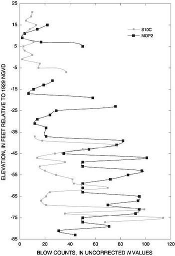
| Keywords: Spt graph.jpg badJPEG http //sofia usgs gov/publications/wri/02-4050/lithologysa html Standard penetration test N values from the Surficial aquifer at sites S10C WCA-2A and MOP2 ENR north-central Everglades south Florida PD-USGov original upload log page en wikipedia Spt_graph jpg 2007-01-18 05 34 Basar 453×661×8 31349 bytes <nowiki>http //sofia usgs gov/publications/wri/02-4050/lithologysa html Standard penetration test N values from the Surficial aquifer at sites S10C WCA-2A and MOP2 ENR north-central Everglades south Florida </nowiki> Geological diagrams Civil engineering | ||||