MAKE A MEME
View Large Image
| View Original: | SoudaBay_chart.jpg (1125x757) | |||
| Download: | Original | Medium | Small | Thumb |
| Courtesy of: | commons.wikimedia.org | More Like This | ||
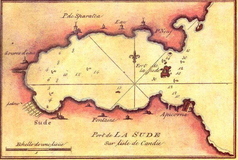
| Keywords: SoudaBay chart.jpg en Old French chart of Souda Bay fr Port de La Sude Recueil des principaux plans des ports et rades de la mer Mediterranée Pl 111 <br>Copied from the website of the Hellenic Navy http //www hellenicnavy gr/upload/TO_LIMANI_THS_SOUDAS jpg Joseph Roux 1725-1793 Hidrographe du Roi 1764 PD-old-100 Old nautical charts Souda Bay Maps of Chania | ||||