MAKE A MEME
View Large Image
| View Original: | Shishmaref 1950-2012 elev.jpg (3200x2196) | |||
| Download: | Original | Medium | Small | Thumb |
| Courtesy of: | commons.wikimedia.org | More Like This | ||
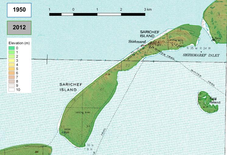
| Keywords: Shishmaref 1950-2012 elev.jpg nl Erosie en sedimentatie van Sarichef eiland in Alaska tussen 1950 en 2012 hoogtekaart en Erosion and sedimentation of Sarichef Island Alaska between 1950 and 2012 elevation map 2016-08-27 own Hans Erren other versions 66 25 -166 066667 Coordinate Reference System EPSG 26703 NAD27 / UTM Zone 3N Lower left corner x 445596 037 y 7344053 642 Upper right corner x 455081 037 y 7350563 642 Source data Topomaps 1950 Shishmaref B-3 https //www topoquest com/map-detail php usgs_cell_id 62476 http //www archive org/download/usgs_drg_ak_66166_c1/i66166c1 tif Shishmaref A-3 https //www topoquest com/map-detail php usgs_cell_id 62472 http //www archive org/download/usgs_drg_ak_66166_a1/i66166a1 tif Elevation 2012 http //ifsar gina alaska edu/ http //ifsar gina alaska edu/data/2012/NWAK/DTM/IFSAR SDMI 2012 INTERMAP DTM_N66W166/IFSAR SDMI 2012 INTERMAP DTM_N66W166 tar gz http //ifsar gina alaska edu/data/2012/NWAK/DSM/IFSAR SDMI 2012 INTERMAP DSM_N66W166/IFSAR SDMI 2012 INTERMAP DSM_N66W166 tar gz cc-zero Shishmaref Alaska | ||||