MAKE A MEME
View Large Image
| View Original: | Saxe_primitive.JPG (576x551) | |||
| Download: | Original | Medium | Small | Thumb |
| Courtesy of: | commons.wikimedia.org | More Like This | ||
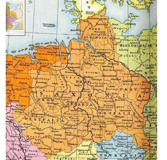
| Keywords: Saxe primitive.JPG Geschichtskarte Das Siedlungsgebiet des germanischen Stammes der Sachsen in Deutschland um das Jahr 700 Saxony about 700AD fr Carte ancienne de la Saxe primitive ou vieille Saxe Allgemeiner historischer Handatlas 1886 Richard Andree Dr Richard Andree 1912 Original upload log en wikipedia Old_Saxony1 JPG 2010-09-26 06 16 Aetheling1125 576×551× 105770 bytes <nowiki> Saxony about 700AD Allgemeiner historischer Handatlas 1886 </nowiki> Uploaded with UploadWizard Saxons History of the Germanic peoples Maps of the history of Lower Saxony Maps of the history of Schleswig-Holstein Maps of the history of North Rhine-Westphalia 800s | ||||