MAKE A MEME
View Large Image
| View Original: | Satirical_map_of_Europe,_1914.jpg (1525x1117) | |||
| Download: | Original | Medium | Small | Thumb |
| Courtesy of: | commons.wikimedia.org | More Like This | ||
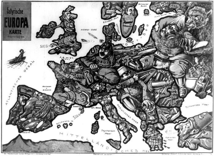
| Keywords: Satirical map of Europe, 1914.jpg Print shows a map of Europe at the outbreak of the first World War with each country depicted as a human figure representative of the particular state of affairs or attitudes of the country for instance Germany is depicted as a soldier fighting with both Russia and France while eyeing England LOC-image cph 3a22758 1914 Hamburg Druck u Verlag W Nölting Kaiser Wilhelmstrasse 93 PD-Old Satirical maps Old maps of Europe 1914 | ||||