MAKE A MEME
View Large Image
| View Original: | Satirical_Map_of_Europe,_1887.jpg (1479x921) | |||
| Download: | Original | Medium | Small | Thumb |
| Courtesy of: | commons.wikimedia.org | More Like This | ||
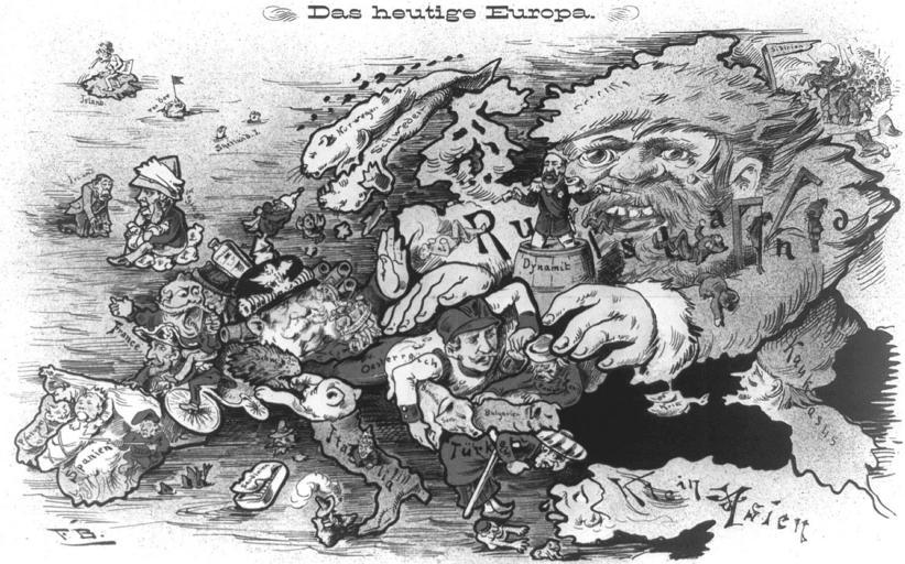
| Keywords: Satirical Map of Europe, 1887.jpg Print shows a map of Europe in 1887 with each country caricatured according to its current political and international circumstances LOC-image cph 3a22919 1887 Zürich Verlag von Caesar Schmidt PD-Old 1887 cartoons Satirical maps Old maps of Europe Lo Stivale boot-shaped Italian Peninsula Georges Boulanger Caricatures of Wilhelm I of Germany Revanchism in France ImageNote 1 233 549 68 70 1479 921 2 Georges Boulanger ImageNoteEnd 1 ImageNote 2 422 468 116 91 1479 921 2 Wilhelm I Deutscher Kaiser ImageNoteEnd 2 | ||||