MAKE A MEME
View Large Image
| View Original: | Sambucus_nigra_cerulea_range_map_3.png (3681x3681) | |||
| Download: | Original | Medium | Small | Thumb |
| Courtesy of: | commons.wikimedia.org | More Like This | ||
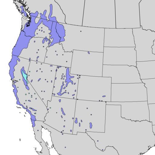
| Keywords: Sambucus nigra cerulea range map 3.png en Natural distribution map for Sambucus nigra subsp cerulea blueberry elder Dark blue is from Little's Sambucus glauca map and light blue is from his Sambucus velutina map 1976 http //esp cr usgs gov/data/little/ USGS Geosciences and Environmental Change Science Center Digital Representations of Tree Species Range Maps from Elbert L Little Jr 1976 Atlas of United States trees Vol 3 minor Western hardwoods U S Department of Agriculture Miscellaneous Publication 1314 13 p 290 maps Elbert L Little Jr of the U S Department of Agriculture Forest Service PD-USGov Sambucus nigra range maps Sambucus cerulea range maps Uploaded with UploadWizard | ||||