MAKE A MEME
View Large Image
| View Original: | Sainte Marie Island-Madagascar-1601.jpg (2888x2040) | |||
| Download: | Original | Medium | Small | Thumb |
| Courtesy of: | commons.wikimedia.org | More Like This | ||
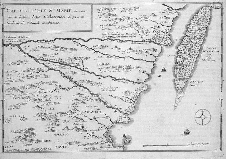
| Keywords: Sainte Marie Island-Madagascar-1601.jpg en map of portion of northeast coast of Madagascar with the islands of Sainte Marie and Île aux Nattes 1601 http //tools wmflabs org/zoomable-images/gallica php height 3000 width 3000 zoom 6 path http //gallica bnf fr/proxy method R 26ark btv1b2300689d f14 Bibliothèque nationale de France Étienne de Flacourt other versions PD-old-70-1923 Old maps of Madagascar Maps made in the 17th century Île Sainte-Marie Île aux Nattes Étienne de Flacourt | ||||