MAKE A MEME
View Large Image
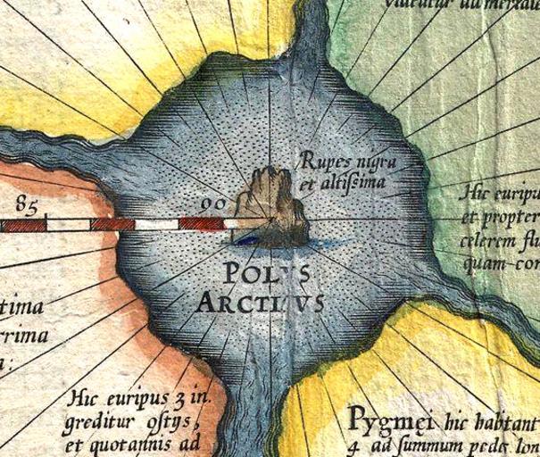
| View Original: | Rupes_Nigra.jpg (564x477) | |||
| Download: | Original | Medium | Small | Thumb |
| Courtesy of: | commons.wikimedia.org | More Like This | ||
| Keywords: Rupes Nigra.jpg en Mercator Septentrionalium Terrarum descriptio A map of the North Pole Detail showing Rupes nigra et altissima the black and very high rock de Ausschnitt aus Gerardus Mercators Karte Septentrionalium Terrarum descriptio einer Karte der Nordpolarregion mit dem žRupes nigra et altissima dem žschwarzen und sehr hohen Felsen direkt am Nordpol Cropped from 1606 Mercator Hondius Map of the Arctic First Map of the North Pole - Geographicus - NorthPole-mercator-1606 jpg creator Gerardus Mercator 1606 PD-old-100 Maps by Gerardus Mercator Old maps of the Arctic Maps made in the 17th century North Pole | ||||