MAKE A MEME
View Large Image
| View Original: | Relief_map_Pacific_Electric_Railway.jpg (6432x3216) | |||
| Download: | Original | Medium | Small | Thumb |
| Courtesy of: | commons.wikimedia.org | More Like This | ||
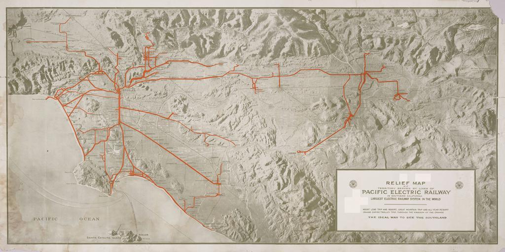
| Keywords: Relief map Pacific Electric Railway.jpg Relief map of territory served by lines of the Pacific Electric Railway in Southern California; largest electric railway system in the world Copyrighted 1920 by O A Smith Railway lines are overprinted in red Includes Santa Catalina Island Mount Lowe trip and resort great mountain trip and all year resort; Orange Empire trolley trip through the Kingdom of Orange 1920 http //content cdlib org/ark /13030/hb638nb72q/ layout metadata Smith O A Cartographer Maps of Los Angeles County California Pacific Electric Railway 1920 in Los Angeles PD-USGov | ||||