MAKE A MEME
View Large Image
| View Original: | RedRockRiverMontana.jpg (4036x2423) | |||
| Download: | Original | Medium | Small | Thumb |
| Courtesy of: | commons.wikimedia.org | More Like This | ||
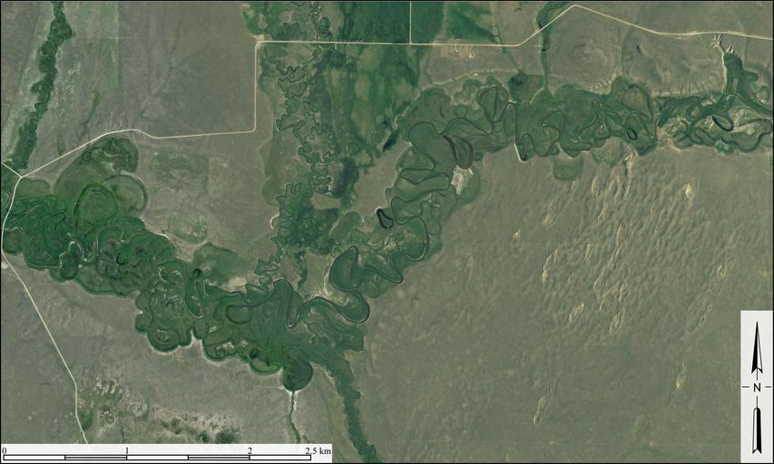
| Keywords: RedRockRiverMontana.jpg en Aerial image of meandering course of Red Rock River in Beaverhead County Montana It shows point bars abandoned meander loops ox bow lakes and terraces associated with the active course of the Red Rock River Excellent example of sand dunes can also be seen in righthand part of image Created from USDA/FSA Aerial Photography Field Office 2010 NAIP digital aerial orthophoto mosaic for Beaverhead County Montana latitude 44° 38 ™ 7 82 longitude -112° 6 ™ 12 13 USDA/NRCS - National Cartography Geospatial Center USDA/NRCS - National Cartography Geospatial Center 2011-05-27 PD-USGov Meanders in the United States Aerial photographs of Montana Floodplain | ||||