MAKE A MEME
View Large Image
| View Original: | Ratzer_fasimile,_NYC_map,_1767.JPG (-3264x2448) | |||
| Download: | Original | Medium | Small | Thumb |
| Courtesy of: | commons.wikimedia.org | More Like This | ||
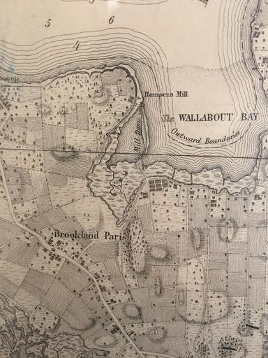
| Keywords: Ratzer fasimile, NYC map, 1767.JPG en Historical map from 1767 was taken from New York Public Library Historical Maps section Represent the area of east river side of Brooklyn and Wallabout Bay 2015-10-21 11 47 24 New York Public Library Historical Maps Ratzer fasimile NYC map 1767 other versions 40 754622222222 -73 977463888889 heading 102 04845814977973 PD-USGov Maps showing history Uploaded with UploadWizard | ||||