MAKE A MEME
View Large Image
| View Original: | Railwaysnetherlands1880.PNG (450x522) | |||
| Download: | Original | Medium | Small | Thumb |
| Courtesy of: | commons.wikimedia.org | More Like This | ||
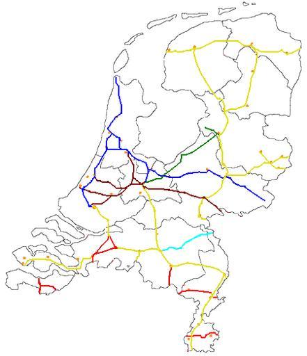
| Keywords: Railwaysnetherlands1880.PNG A maps of the railway network in the Netherlands in 1880 showing the different operators blue HSM brown NSR Yellow SS Teal NBDS Green NCS Red other companies Based on this map De red track at the most souther tip is not correct the eastern part should be serveral km more to the south own 2007-05-20 Crownsteler 20 39 20 June 2007 UTC Rail transport maps of the Netherlands countrywide | ||||