MAKE A MEME
View Large Image
| View Original: | Pre-Oil_Reconnaissance_Flight.jpg (3648x2736) | |||
| Download: | Original | Medium | Small | Thumb |
| Courtesy of: | www.flickr.com | More Like This | ||
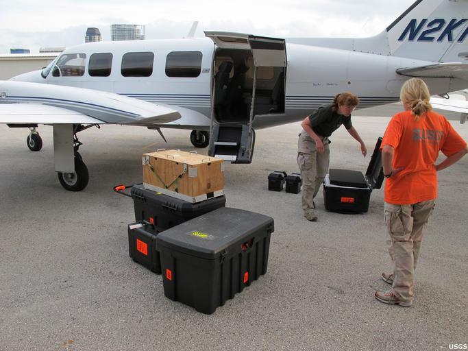
| Keywords: deepwaterhorizon oilspill usgs equipment measurement personnel research outdoor USGS geologists Karen Morgan and Ginger Tiling-Range load imaging gear for a pre-oil reconnaissance flight. USGS captured more than 350 miles of Florida's coastline, from Cedar Key to Flamingo, with over 9,800 aerial photographs. The photographs document conditions along Florida's coastline in advance of the arrival of oil from the Deepwater Horizon incident. Visit usgs.gov/deepwater_horizon for more information related to the USGS efforts in the Gulf of Mexico. USGS geologists Karen Morgan and Ginger Tiling-Range load imaging gear for a pre-oil reconnaissance flight. USGS captured more than 350 miles of Florida's coastline, from Cedar Key to Flamingo, with over 9,800 aerial photographs. The photographs document conditions along Florida's coastline in advance of the arrival of oil from the Deepwater Horizon incident. Visit usgs.gov/deepwater_horizon for more information related to the USGS efforts in the Gulf of Mexico. | ||||