MAKE A MEME
View Large Image
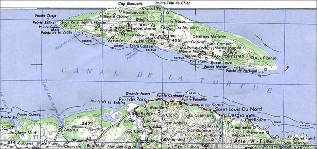
| View Original: | Port_de_paix_regio_map.jpg (800x377) | |||
| Download: | Original | Medium | Small | Thumb |
| Courtesy of: | commons.wikimedia.org | More Like This | ||
| Keywords: Port de paix regio map.jpg en Map of the vicinity of Port-de-Paix including Île de la Tortue Tortuga island to the North topographic 1 250 000 U S G S 1984 2012-01-07 http //thelouvertureproject org/index php title File Port_de_paix_area_map jpg This work is in the public domain because it is a work of the United States federal Government This applies worldwide See Copyright Port de paix en La Tortue Tortuga eiland in het noorden PD-USGov Uploaded with UploadWizard Maps of Haiti | ||||