MAKE A MEME
View Large Image
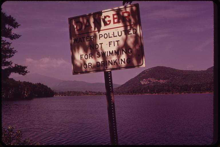
| View Original: | POLLUTED_ANDROSCOGGIN_RIVER_IN_THE_"SHELBURNE_BIRCHES"_AREA_NEAR_THE_MAINE-NEW_HAMPSHIRE_BOUNDARY_-_NARA_-_550688.tif (3000x2008) | |||
| Download: | Original | Medium | Small | Thumb |
| Courtesy of: | commons.wikimedia.org | More Like This | ||
| Keywords: POLLUTED ANDROSCOGGIN RIVER IN THE "SHELBURNE BIRCHES" AREA NEAR THE MAINE-NEW HAMPSHIRE BOUNDARY - NARA - 550688.tif Scope and content General notes 550688 Local identifier 412-DA-8203 Environmental Protection Agency 12/02/1970 - NARA-Author Steinhacker Charles 1937- Photographer 1660401 <br /> Berlin Coos New Hampshire United States North and Central America inhabited place 3353276 44 467 -71 183 <br /> Still Picture Records Section Special Media Archives Services Division NWCS-S National Archives at College Park 8601 Adelphi Road College Park MD 20740-6001 06/1973 Record group Record Group 412 Records of the Environmental Protection Agency 1944 - 2006 Record group ARC 708 DOCUMERICA The Environmental Protection Agency's Program to Photographically Document Subjects of Environmental Concern compiled 1972 - 1977 Series ARC 542493 File unit File unit ARC Variant control numbers Agency-Assigned Identifier 137/43/008203<br /> NAIL Control Number NWDNS-412-DA-8203 yes Other versions <gallery> File POLLUTED_ANDROSCOGGIN_RIVER_IN_THE_ SHELBURNE_BIRCHES _AREA_NEAR_THE_MAINE-NEW_HAMPSHIRE_BOUNDARY_-_NARA_-_550688 tif tif File POLLUTED_ANDROSCOGGIN_RIVER_IN_THE_ SHELBURNE_BIRCHES _AREA_NEAR_THE_MAINE-NEW_HAMPSHIRE_BOUNDARY_-_NARA_-_550688 jpg jpg </gallery> NARA-cooperation PD-USGov NARA TIF images with categorized JPGs | ||||