MAKE A MEME
View Large Image

| View Original: | Plan_Treme_New_Orleans_1810.jpg (798x599) | |||
| Download: | Original | Medium | Small | Thumb |
| Courtesy of: | commons.wikimedia.org | More Like This | ||
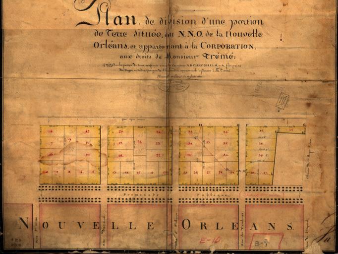
| Keywords: Plan Treme New Orleans 1810.jpg Plan de division d'une portion de terre situee au N N O de la Nouvelle Orleans et appartenant a la Corporation aux droits de Monsieur Treme 1810 map of a section of New Orleans with wide Rampart Street horizontally at lower center showing earlier development of Faubourg Treme neighborhood; St Anne Street is the vertical street furthest left 1810 map via http //louisdl louislibraries org/cdm4/item_viewer php CISOROOT 2Flapur CISOPTR 5308 DMSCALE 88 88889 DMWIDTH 800 DMHEIGHT 600 DMMODE viewer DMFULL 0 DMOLDSCALE 16 37555 DMX 0 DMY 0 DMTEXT 2520structures DMTHUMB 1 REC 2 DMROTATE 0 x 34 y 138 1810 Jacques Tanesse Note New Orleans surveyer and mapmaker Tanesse variously credited as John Jean and Jacques; apparently same person PD-old-100 1810 maps 1810 in New Orleans old maps of New Orleans Treme New Orleans Rampart Street New Orleans J Tanesse of New Orleans | ||||