MAKE A MEME
View Large Image

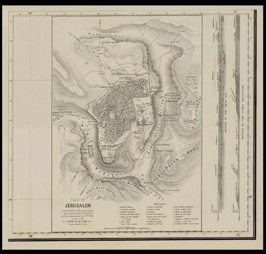
| View Original: | Plan_of_Jerusalem_-_constructed_from_the_survey_made_by_Lieut._Symonds_in_March_1841,_and_from_measurements_by_Tobler_in_1845&1846_by_C.W.M._van_de_Velde,_late_Lieut.jpg (2550x2436) | |||
| Download: | Original | Medium | Small | Thumb |
| Courtesy of: | commons.wikimedia.org | More Like This | ||
| Keywords: Plan of Jerusalem - constructed from the survey made by Lieut. Symonds in March 1841, and from measurements by Tobler in 1845&1846 by C.W.M. van de Velde, late Lieut.jpg ū×ūżūö ū®ū ūÖū©ūĢū®ū ūÖū http //web nli org il/sites/NLI/Hebrew/digitallibrary/Laor-Collection/Pages/maps aspx en Jerusalem measurement map by Van de Velde 1858 Inset in the author's Map of the Holy Land he ū×ūżū¬ ū×ūōūĢūÖū¦ū¬ ū®ū ūÖū©ūĢū®ū ūÖū ū×ūÉū¬ ūĢū¤-ūōūö ūĢū ūōūö 1858 ūæū¬ūĢūÜ ū×ūżū¬ ūÉū©ūź ūÖū®ū©ūÉū ū®ū ūöū×ūŚūæū© Dimensions 315 X 220 mm http //web nli org il/sites/NLI/Hebrew/digitallibrary/pages/viewer aspx presentorid NLI_MAPS_JER DocID NNL_MAPS_JER002370465 Click to enlarge http //web nli org il/sites/NLIS/en/Maps The Eran Laor Cartographic Collection National Library of Israel 2015-12-09 12 27 50 http //web nli org il/sites/NLI/English/Pages/default aspx The National Library of Israel PD-old Old maps of Jerusalem GLAM National Library of Israel Laor collection | ||||