MAKE A MEME
View Large Image
| View Original: | Plan du Fort des Sauvages Renards.jpg (6091x2942) | |||
| Download: | Original | Medium | Small | Thumb |
| Courtesy of: | commons.wikimedia.org | More Like This | ||
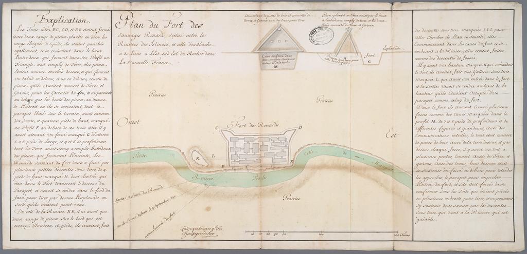
| Keywords: Plan du Fort des Sauvages Renards.jpg fr Plan du Fort des Sauvages Renards scituĂ© entre les Rivières des Islinois et celle d'oudbache a 50 lieĂĽe a LEst-sud-Est du Rocher dans La Nouvelle France<br> « MACOPIN nom que l'on donne depuis peu a une partie de la Rivière des Ilinois comprise depuis la Rivière de ChĂ©cagon jusqu'aux Miamis » “ https //books google ca/books id BflIAAAAcAAJ pg RA1-PT477 lpg RA1-PT477 dq rivi C3 A8re+de+Macopin source bl ots Jp8irklvos sig fkMeNi0Debp-Mj9og6ttPr9aZKM hl fr sa X ved 0ahUKEwjQ-L-hg_XQAhVMxWMKHW_4Bq4Q6AEIITAC v onepage q rivi C3 A8re 20de 20Macopin f false books google ca en Plan of the Fort of the Fox Indians by the French and Indians located between the Rivers of the Illinois and the one the Wabash 50 leagues to the East-South-East of the Rock in New France 1730-11-10 http //virtual parkland edu/lstelle1/len/center_for_social_research/1_a_meskwaki 20web/historical 20maps/Plan 20du 20fort_10 20Nov_large jpg virtual parkland edu - http //virtual parkland edu/lstelle1/len/center_for_social_research/1_a_meskwaki 20web/ml6 htm Gaspard-Joseph Chaussegros de Lery other versions PD-old-70-1923 1730 maps Illinois River Gaspard-Joseph Chaussegros de LĂ©ry Sac and Fox | ||||