MAKE A MEME
View Large Image
| View Original: | Pinelli-Walckenaer_Atlas_(p._3).jpg (4000x2682) | |||
| Download: | Original | Medium | Small | Thumb |
| Courtesy of: | commons.wikimedia.org | More Like This | ||
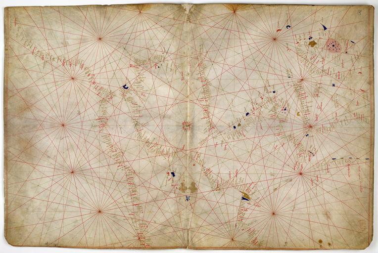
| Keywords: Pinelli-Walckenaer Atlas (p. 3).jpg The third sheet of the seven-sheet Pinelli-Walckenaer Atlas a set of Italian w portolan chart s depicting the west Mediterranean and north Atlantic coast including the British Isles it is oriented with West on top Dated 1384 although in reality possibly made a little later c 1385 “1410 and with additions from c 1434 Ink and tempera on parchment cm 29 4 45 0 Institution British Library London England United Kingdom accession number Additional M S 19510 folios 2v-3 object history credit line http //www bl uk/onlinegallery/onlineex/unvbrit/n/001add000019510u00002vrb html http //ogimages bl uk/images/001/001ADD000019510U00002VRB 5BSVC2 5D jpg other versions PD-old-100 Maps of Western Europe Pinelli-Walckenaer Atlas | ||||
.jpg)