MAKE A MEME
View Large Image
| View Original: | Photograph_of_Marker_Located_on_State_Highway_Number_38_-_NARA_-_2128864.tif (1256x947) | |||
| Download: | Original | Medium | Small | Thumb |
| Courtesy of: | commons.wikimedia.org | More Like This | ||
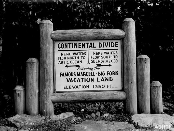
| Keywords: Photograph of Marker Located on State Highway Number 38 - NARA - 2128864.tif Scope and content Original caption Marker located on State Highway 38 on the Marcell Ranger District indicating the north-south Continental Divide which runs through the center of the Chippewa NF Water in the northern half flowing into the Arctic Ocean and water in the Southern half flo General notes 2128864 Local identifier 401101 Department of Agriculture Forest Service Region 9 Eastern Region 1965 - Most Recent <br /> Department of Agriculture Division of Forestry 1881 - 07/01/1901 Predecessor NARA-Place Chippewa National Forest Minn 4509445 <br /> NARA's Great Lakes Region Chicago NRDA 7358 South Pulaski Road Chicago IL 60629-5898 08/1940 Record group Record Group 95 Records of the Forest Service 1870 - 2008 Record group ARC 424 Historic Photographs compiled ca 1880 - ca 1970 Series ARC 1812856 File unit File unit ARC Variant control numbers Agency-Assigned Identifier 401101 yes Other versions <gallery> File Photograph_of_Marker_Located_on_State_Highway_Number_38_-_NARA_-_2128864 tif tif File Photograph_of_Marker_Located_on_State_Highway_Number_38_-_NARA_-_2128864 jpg jpg </gallery> NARA-cooperation PD-USGov NARA TIF images with categorized JPGs | ||||