MAKE A MEME
View Large Image
| View Original: | Photograph_of_Dead_River_-_NARA_-_2128791.jpg (1267x960) | |||
| Download: | Original | Medium | Small | Thumb |
| Courtesy of: | commons.wikimedia.org | More Like This | ||
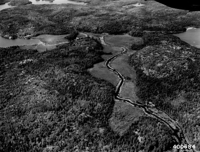
| Keywords: Photograph of Dead River - NARA - 2128791.jpg Scope and content Original caption Dead River flowing into Burntside Lake upper left La Croix Ranger District General notes 2128791 Local identifier 400684 Department of Agriculture Forest Service Region 9 Eastern Region 1965 - Most Recent <br /> Department of Agriculture Division of Forestry 1881 - 07/01/1901 Predecessor NARA-Place Superior National Forest Lake Minnesota forest 4075007 47 75 -91 5 <br /> NARA's Great Lakes Region Chicago NRDA 7358 South Pulaski Road Chicago IL 60629-5898 07/1940 Record group Record Group 95 Records of the Forest Service 1870 - 2008 Record group ARC 424 Historic Photographs compiled ca 1880 - ca 1970 Series ARC 1812856 File unit File unit ARC Variant control numbers Agency-Assigned Identifier 400684 Other versions <gallery> File Photograph_of_Dead_River_-_NARA_-_2128791 tif tif File Photograph_of_Dead_River_-_NARA_-_2128791 jpg jpg </gallery> NARA-cooperation PD-USGov Superior Hiking Trail | ||||