MAKE A MEME
View Large Image
| View Original: | Petrus_Roselli._Carte_marine_de_l'océan_Atlantique_Nord-Est_de_la_mer_Méditerranée_et_de_la_mer_Noire._1462.jpg (6658x5000) | |||
| Download: | Original | Medium | Small | Thumb |
| Courtesy of: | commons.wikimedia.org | More Like This | ||
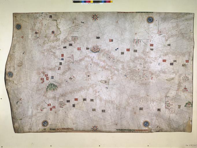
| Keywords: Petrus Roselli. Carte marine de l'océan Atlantique Nord-Est de la mer Méditerranée et de la mer Noire. 1462.jpg Artwork Petrus Roselli Piero Roselli fr Carte marine de l'océan Atlantique Nord-Est de la mer Méditerranée et de la mer Noire Majorque / Petrus Roselli composuit hanc cartam/in civitate Maioricarum anno domini/ MCCCCLXII 1462 Date of publication cm 53 83 Institution Bibliothèque nationale de France Paris accession number CPL GE C-5090 RES object history credit line ark /12148/btv1b59011914 r PD-GallicaScan PD-Art-100 Old maps of the Black Sea Petrus Roselli Old maps of Europe Maps of the Mediterranean Basin 15th-century maps of Georgia 1462 maps Medieval maps in Catalan 15th-century maps of Madeira 15th-century maps of Portugal | ||||