MAKE A MEME
View Large Image
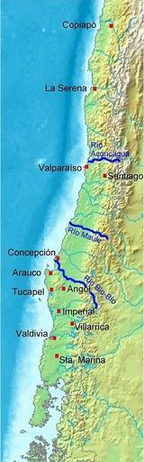
| View Original: | Pedro De Valdivia Siedlungen in Chile 1540 bis 1553.jpg (300x962) | |||
| Download: | Original | Medium | Small | Thumb |
| Courtesy of: | commons.wikimedia.org | More Like This | ||
| Keywords: Pedro De Valdivia Siedlungen in Chile 1540 bis 1553.jpg Karte von Chile Pedro de Valdivia Koloniale Siedlungen in Chile 1540 - 1553 Map of Chile Pedro de Valdivia Locations of colonization in Chile 1540 - 1553 Mapa de Chile Pedro de Valdivia Fundaciones en Chile 1540 - 1553 Map_of_Chile_Demis png 2008-07-20 18 11 UTC derivative work WeHaKa talk Map_of_Chile_Demis png www demis nl www demis nl Orte eingezeichnet/locations added WeHaKa Map_of_Chile_Demis png PD-Demis original upload log This image is a derivative work of the following images Image Map_of_Chile_Demis png licensed with PD-Demis 2006-12-20T19 50 53Z Mats Halldin 343x1458 269160 Bytes <nowiki>Map of Chile Bounding box West -78° South -57° East -66° North -16° Center at 36 50000 S 72 00000 W scale 24600000 demis-pd maps of Chile </nowiki> Uploaded with derivativeFX Maps of the history of South America Pedro de Valdivia | ||||