MAKE A MEME
View Large Image
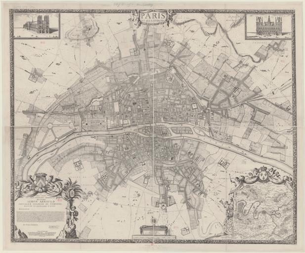
| View Original: | Paris_map_1672_(Jouvin_de_Rochefort)_1-4_reduction_-_Gallica.jpg (16855x13990) | |||
| Download: | Original | Medium | Small | Thumb |
| Courtesy of: | commons.wikimedia.org | More Like This | ||
| Keywords: Paris map 1672 (Jouvin de Rochefort) 1-4 reduction - Gallica.jpg LargeImage 6229765 plate XX consisting of four plates 58 x 67 cm each the original at scale c 1 4600 consisted of 9 plates c 49 x 60 cm each http //gallica bnf fr/ark /12148/btv1b53010929s r langEN Gallica Albert Jouvin de Rochefort 16 “17 TrĂ©sorier de France http //viaf org/viaf/49527333 VIAF<br />François de La Pointe fl 1666 “1690 engraver <br />Pierre Brissar 16 -1682 graphic artist http //viaf org/viaf/227075297 VIAF<br />Jacqueline Panouze scripsit 1672 <gallery>File 1672 Plan de Jouvin de Rochefort jpg <center>lower resolution</center></gallery> Maps of Paris in the 17th century 1672 17th-century maps of Paris 1672 Paris in the 1670s François de La Pointe PD-old-100 | ||||
_1-4_reduction_-_Gallica.jpg)