MAKE A MEME
View Large Image
| View Original: | Panorama de la ville de Paris par AM Perrot - Gallica 2.jpg (6189x4492) | |||
| Download: | Original | Medium | Small | Thumb |
| Courtesy of: | commons.wikimedia.org | More Like This | ||
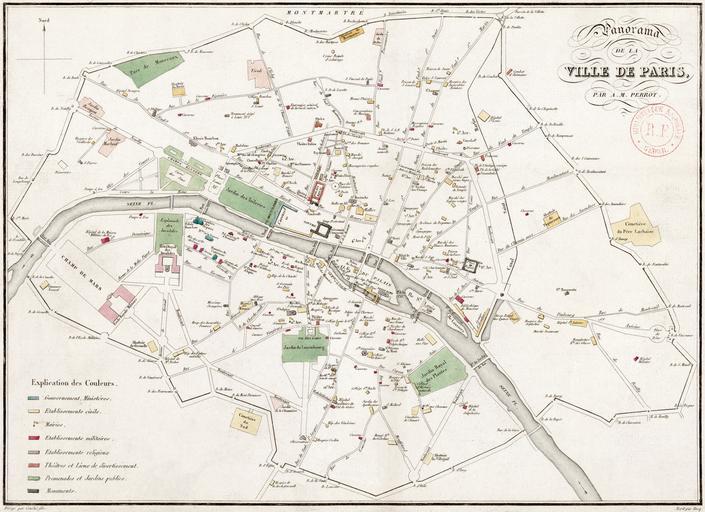
| Keywords: Panorama de la ville de Paris par AM Perrot - Gallica 2.jpg en Map 38 x 28 cm showing Paris as it was in the first part of 1826 with the title Panorama de la ville de Paris / par A -M Perrot The map indicates the locations of important buildings promenades and gardens and other monuments using a color code which is explained in the legend in the lower left corner Explication des couleurs North is up The scale is not shown http //gallica bnf fr/ark /12148/btv1b84414797 r langEN Gallica Aristide-Michel Perrot 1793 “1879 cartographer http //viaf org/viaf/12609172 VIAF <br />« DirigĂ© par CouchĂ© fils » lower left <br />« Écrit par Hacq » lower right 1826 see talk Maps of Paris in the 19th century 1826 1826 maps Paris 1826 in Paris Images from Gallica Images of Paris from Bibliothèque nationale de France Aristide-Michel Perrot 19th-century maps of Paris PD-old-100 | ||||