MAKE A MEME
View Large Image
| View Original: | Pakistan Earthquake Island.png (1222x1628) | |||
| Download: | Original | Medium | Small | Thumb |
| Courtesy of: | commons.wikimedia.org | More Like This | ||
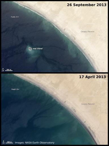
| Keywords: Pakistan Earthquake Island.png island which appeared of the coast of w Gwadar Balochistan Pakistan following the w 2013 Pakistan earthquake The new island is believed to be the result of a w mud volcano The two satellite images are from NASA http //earthobservatory nasa gov/NaturalHazards/view php id 82146 found here and as a work of the U S government are in the public domain This illustration combining the two satellite images has also been released into the public domain by its creator 2013-09-28 NASA satellite images from http //earthobservatory nasa gov/NaturalHazards/view php id 82146 AHeneen 26 Sept 2013 satellite image only File Zalzala Jazeera 2013 Gwadar jpg 25 1796 62 2307 cc-zero Uploaded with UploadWizard Mud volcanoes | ||||