MAKE A MEME
View Large Image
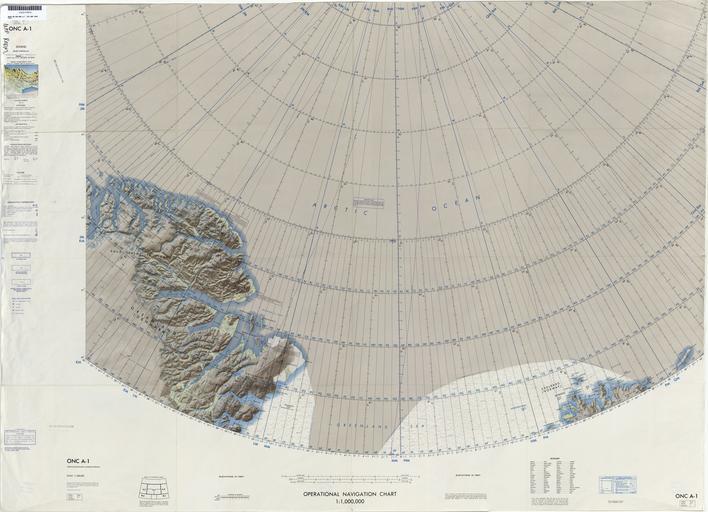
| View Original: | Operational_Navigation_Chart_A-1,_1st_edition.jpg (9254x6693) | |||
| Download: | Original | Medium | Small | Thumb |
| Courtesy of: | commons.wikimedia.org | More Like This | ||
| Keywords: Operational Navigation Chart A-1, 1st edition.jpg en 1 1 000 000 scale Operational Navigation Chart Sheet A-1 1st edition Covers Greenland Denmark and Svalbard Norway Polar Stereographic Projection Central longitude 0 47 30W 1969-06 txu-pclmaps-oclc-8322829_a_1 jpg onc/ Aeronautical Chart and Information Center U S Air Force St Louis Mo Covers 80N to 88N 36W to 34E PD-USGov Uploaded with UploadWizard ONCs uploaded by Revent Operational Navigation Chart Maps of Greenland Maps of Svalbard Maps of the Arctic Ocean Maps with stereographic projection JPG maps Operational Navigation Charts in the Perry-Castañeda Library Maps of the Greenland Sea Maps of the Lincoln Sea Maps of the Wandel Sea | ||||